<< Back to Articles Index page
Old Parish Maps
Ogilby (1675) – Donn (1765) – Simcoe (1798) – OS 1Ed (1824) – Tithe (1838)
Ogilby (1675)
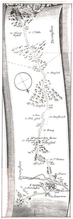
An extract (Exeter to Chudleigh) from Ogilby's strip map of 1675
John Ogilby [Wikipedia] (November 1600 – 4 September 1676) was a Scottish translator and cartographer best known for publishing the first British road atlas. His Britannia road atlas published in 1675 comprised 100 plates. Chudleigh being on the route from London to Plymouth was included in plate 27 and that extract is shown above.
The mileages shown are those from London and it is interesting to note that ninety-one years later milestones were placed in almost those exact locations. The map has some unusual spellings and omits information that would seem to us relevant. But it is easy to follow the route out from Alphington, through the two Shillingford's, to Clapham, up and over Haldon and into Chudleigh parish (where the hatched line shows). The '181' marker being the location of Milestone Cross.
Donn (1765)
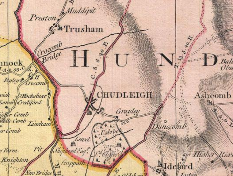
An extract from Benjamin Donn's map of 1765
Benjamin Donn [Wikipedia] or Donne (1729 – 1798) was an English mathematician. In 1798, Donn published a map of Devonshire – a survey he undertook himself and for which he received £100 from the Society of Arts. He published further maps of the West Country and produced mathematical instruments.
Attribution: By http://www.geographicus.com/mm5/cartographers/donn.txt [Public domain], via Wikimedia Commons
Simcoe (1798)
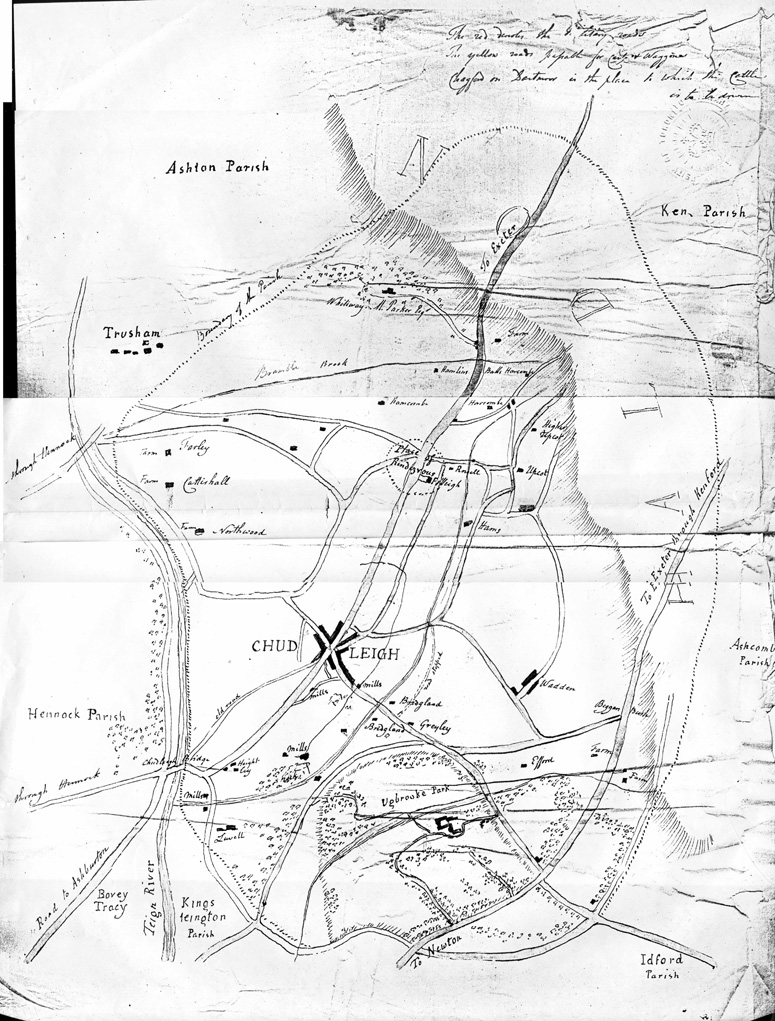
A map hand-drawn for General Simcoe of the parish in about 1798
John Graves Simcoe [Wikipedia] (February 25, 1752 – October 26, 1806) was a British army general and the first Lieutenant Governor of Upper Canada from 1791 until 1796, and was a founding father of York (now Toronto) and the developement of Upper Canada. Due to ill health, he returned to Britain and lived (and died) in Exeter, his mother's birthplace. Simcoe was buried in Wolford Chapel on the Simcoe family estate near Honiton and has a memorial in Exeter Cathedral.
This copy of the map has come to the CHG from Canada. The original is held in the Non-Canadian Papers in the Simcoe Papers Collection. They were given by the Simcoes to the University of Toronto; The University of Toronto transferred them to the Archives of Ontario which have now moved to York University, still in Toronto. The map dates from the year that Simcoe resigned his post in Canada and, as a military man, perhaps had the maps drawn up of places he might visit. There is no known direct connection of Simcoe with Chudleigh.
OS 1st Edition (c1824)
Ordnance Survey maps were the result of the first ever national survey of England & Wales. From the late 1790s until 1874, surveyors covered every corner of a then mainly rural country. The maps recorded the landscape details with every farm, track, copse and hamlet, many of which would have been unchanged for centuries and reflecting ancient patterns of settlement dating back to Saxon times.
The first OS Old Series Edition – one-inch-to-the-mile (1:63,360 scale) – maps were first published between 1805 and 1874; most of southern England being completed by 1810, a third of England & Wales by 1822 but the complete set was not available until 1874. The Cornwall, Devon & Somerset maps were published in 1809.
"At intervals during the cutting of the copper plates, proofs were pulled to monitor the work ... It was also normal practice to to send the proofs into counties so that the spelling of place-names could be verified ... In 1808, a year before publication, we find Mudge sending General Morse 'five sheets of the Map of Devon, with parts of Somerset and Cornwall, the same being impressions from the Copper Plates in their present state'. (Ref. page 70)
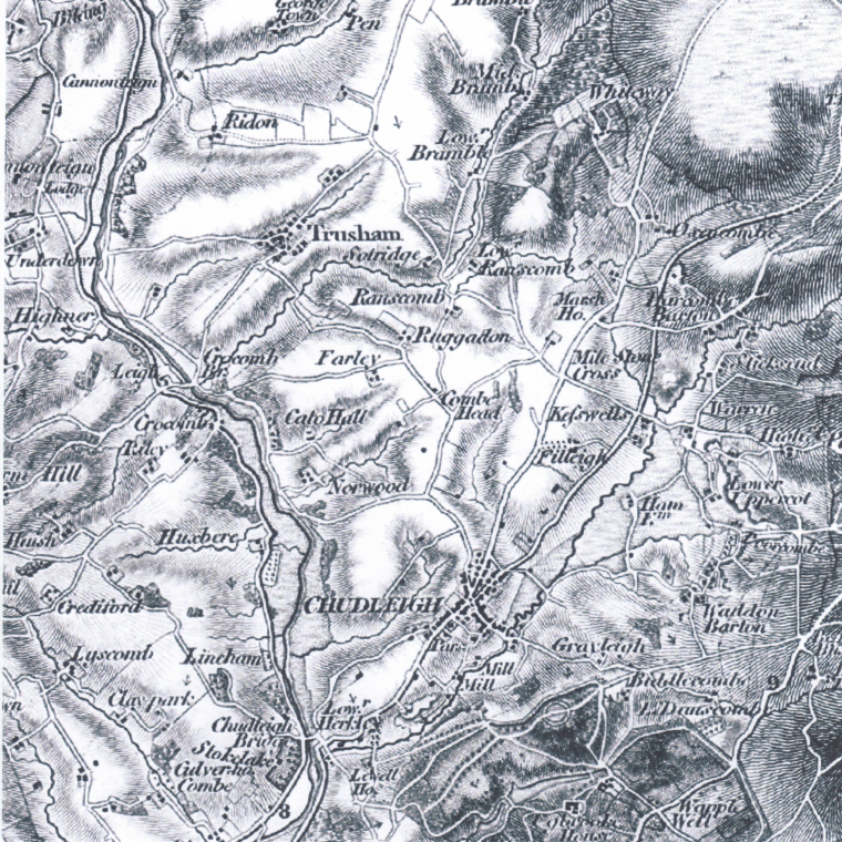
An extract from the Ordnance Survey 1st Edition (Revision) of about 1824.
Although labelled Old Edition 1809, it is believed that the above Devon sheet is not earlier than the Revision (correcting errors and omissions in – and new features like canals and road since – the original surveys) of c1822–1834, as it shows the main road to Exeter via Harcombe Bends which was only created by the Exeter Turnpike Trust in 1822.
"The correction of imperfect work covering 18,000 square miles had been completed by 1834 when Colby reported on the progress ... He drew attention to the corrections that had been made to the old Devonshire map ... as well as many other alterations to the published plates to prevent the maps from becoming obsolete." (Ref. page 103)
The exact date is uncertain, but we infer from the OS histories that the above revised map sheets for Devon were published early in the period, around 1824.
Reference: A History of the Ordnance Survey by WA Seymoor (Ed), 1980. ( PDF copy freely available from the Ordnance Survey website)
Tithe (1838)
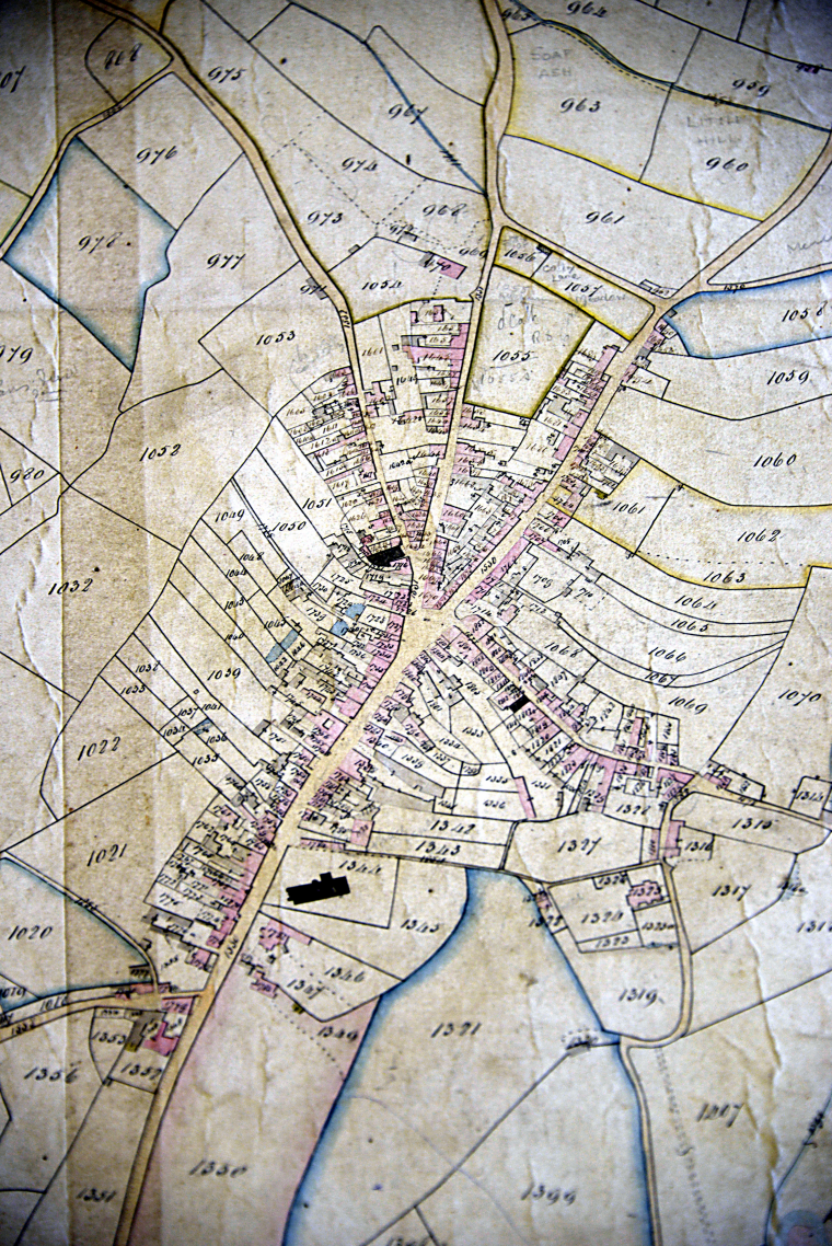
Detail of Chudleigh town centre from the 1838 tithe map
A tithe map indicates the ownership of all parish properties – whether building, field, orchard, etc – for tithe (tax) purposes. The Chudliegh tithe map of 1838 has a number against every such property and there was a companion Tithe Apportionment list, providing a 'look up table' to convert the numers on the map to the name of the owner of that property. The map is drawn on several sheets of velum glued togther, forming a complete parish map some 5 x 4 metres in size.